
Orienteering is, according to the state park's website, "the art of map and compass reading." Basically, we picked up this flyer at the office.

It is not a trail map. Instead it reveals the area where each marker post is located. Those are the circles you see on the map. Each marker post is numbered or lettered. They look like this:
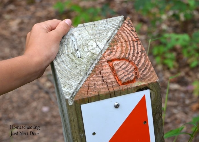
The upper left corner shows the marker post number and the lower right corner is the letter you write on your brochure to prove you actually saw the marker post.
From post to post you are on your own. With the aid of the map, a compass, and your own ingenuity, you decide how to get from post to post.

You can walk or run to the next marker.

We chose to walk, or be carried...

It took us about two hours or so to find all the markers - a bit long for little legs.
Some of the marker posts were easy to find. Others were a bit more tricky.


We found each and every one. {Mainly because it was important to our oldest son to finish the course and we wanted to support him.}

In the end, we were all glad we had found each marker post and finished the course...even our not so outdoorsy gal...after all, it counted for a day of school and she "didn't even have to do Latin."
No comments:
Post a Comment